wildfire high confidence
Matthew Creek Fire Area Restriction Reduced Near Kimberley
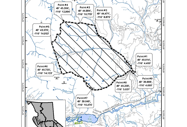
BC Wildfire Service reduced the size of its area restriction zone around the Matthew Creek fire (N11020), roughly 10 km west of Kimberley in the East Kootenay, effective 1 p.m. MT Sept 3, after weeks of firefighting combined with favourable weather reduced fire activity. The fire, discovered Aug 15 and suspected lightning-caused, is mapped at 1,826 hectares and has been classified as being held since Aug 19. The revised, smaller restriction remains enforceable through Oct 31 and covers only Crown land; the Matthew Creek Forest Service Road stays closed to public travel.
Media
Sources
- T3 e-KNOW Institutional western