PCG and Chinese Embassy Clash Over 1875 Spanish-Era Map Supporting Philippine SCS Claims
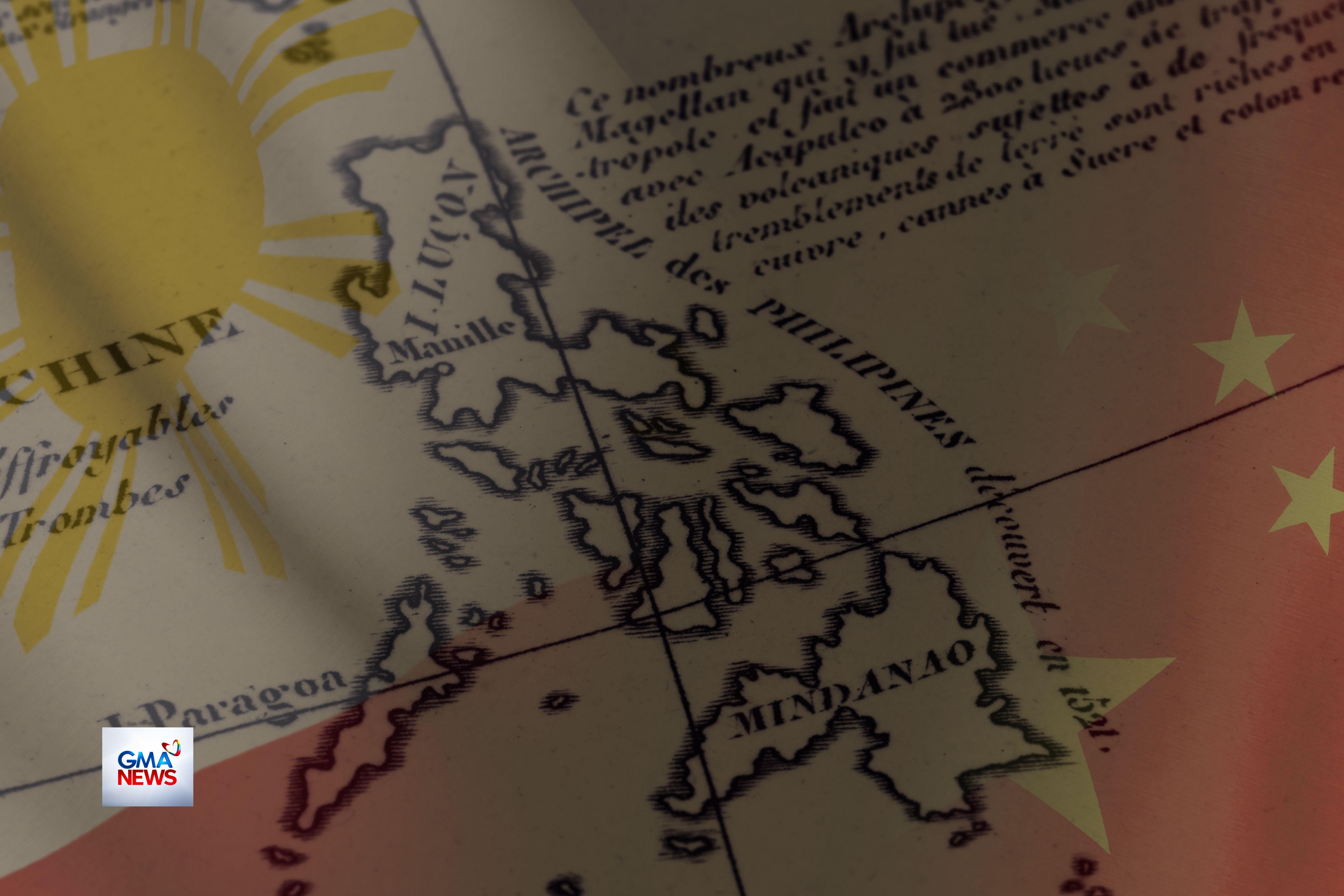
The ongoing exchange between the Philippine Coast Guard and the Chinese Embassy in Manila intensified in early April over PCG spokesperson Rear Admiral Jay Tarriela's citation of the 1875 Carta General del Archipiélago Filipino — a Spanish colonial map — as historical proof supporting the Philippines' maritime claims. Chinese Embassy spokesperson Guo Wei dismissed the document as 'merely a geographical map' with no sovereignty implications, while Philippine lawmakers endorsed the historical map argument as complementary to EO 111. The Institute for Maritime and Ocean Affairs (IMOA) documented the continuing public diplomacy battle, noting that the PCG's transparency strategy — releasing high-quality images, historical documents, and video evidence through social media — continued to shape international narrative strongly in Manila's favor. The confrontation followed PLA Southern Theater Command's March 30 release of combat readiness patrol video near Scarborough Shoal and the CCG deployment near Batanes Islands on April 1.
Media
Sources
- T2 GMA News Major western
- T3 Institute for Maritime and Ocean Affairs (IMOA) Institutional western
- T1 Philippine Coast Guard Official western